
Census place · GEOID 2148006 · Jefferson County
Louisville/Jefferson County metro government (balance), KY ZIP codes
31 ZIP/ZCTAs intersecting this Census place in Jefferson County.
U.S. Census Bureau, ACS 2019–2023 5-year (vintage 2023). Geography: Census place Louisville/Jefferson County metro government (balance) (GEOID 2148006). Methodology
Combined population of ZIP/ZCTAs intersecting this place: 732,042 (31 ZIPs).
Combined population of ZIP/ZCTAs intersecting this place. Each intersecting ZIP contributes its full ZCTA population; overlap percents are descriptive only. This is not the Census place ACS headline above. Methodology
Map of Louisville/Jefferson County metro government (balance), KY
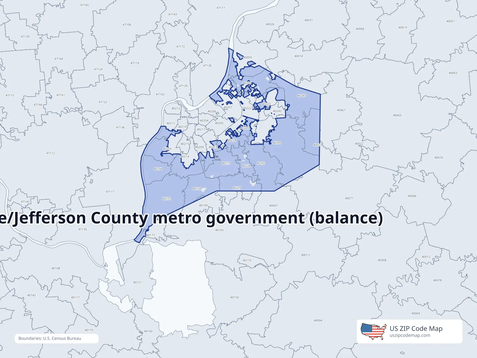
ZIP/ZCTA overlap with Louisville/Jefferson County metro government (balance)
Population overlap
Share of each ZIP/ZCTA’s population located within Louisville/Jefferson County metro government (balance), based on ZIP Code Database place-overlap data. This is a population measure, not land-area overlap or the Census-place population.
- 400140.1%
- 4002353.1%
- 400256.5%
- 400470.2%
- 4005935.6%
- 401091.2%
- 4011894.8%
- 401778.8%
- 402050.5%
- 402075.2%
- 402090.0%
- 402107.4%
- 402112.2%
- 4021335.4%
- 4021447.2%
- 4021655.5%
- 4021859.2%
- 40219100.0%
- 4022039.6%
- 402229.2%
- 4022339.2%
- 4022894.1%
- 4022964.5%
- 4024180.8%
- 402427.1%
- 402433.1%
- 4024584.4%
- 40258100.0%
- 4027299.6%
- 4029197.7%
- 4029952.5%
ZIP Code Database place-overlap table, field percent_of_zip_population_in_place, keyed by place_geoid. Not ACS 2019–2023. Overlap vintage is the shipped overlap table and is separate from ACS. Methodology