
ZIP code
55450
Minneapolis, MN
55450 covers Minneapolis in Hennepin County, with 0 people in the ACS 2023 estimate.
Figures are for the Census ZIP Code Tabulation Area (ZCTA), which is not the same as a USPS ZIP code. A PO Box or unique ZIP may have no ZCTA and no demographics. Methodology
U.S. Census Bureau, ACS 2019–2023 5-year (vintage 2023). Geography: ZCTA 55450. Methodology
ZIP code map of 55450
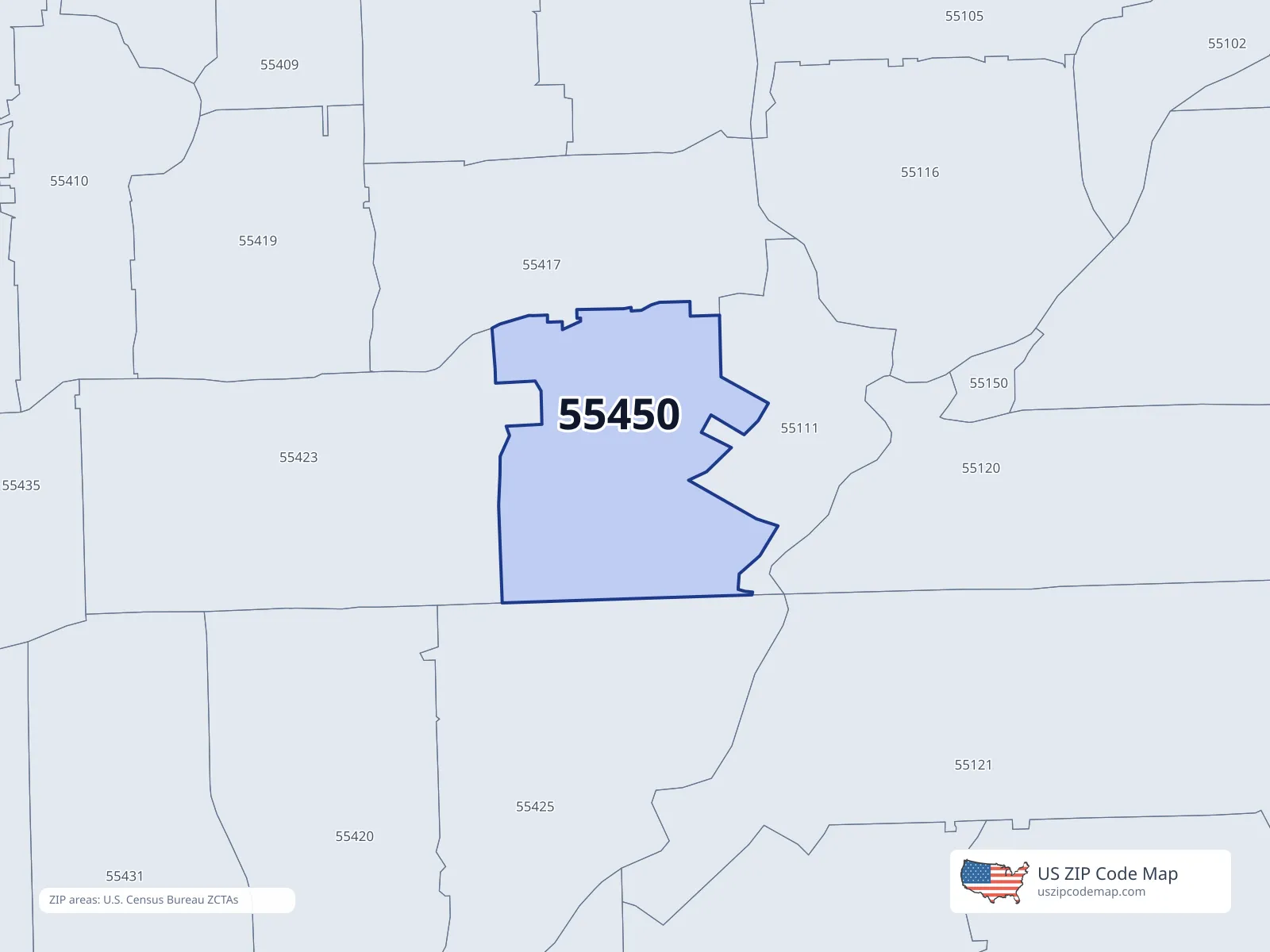
About ZIP code 55450
More enterprise fields
Commercial ZIP directory · not ACS
Commercial ZIP directory population_count for ZCTA 55450. Not ACS. Methodology
People in 55450
Race
- White5
- Black or African American11
- American Indian or Alaska Native5
- Asian2
- Other race2
- Two or more races2
Hispanic or Latino (any race): 2
Age
- Under 102
- 10 to 194
- 20 to 295
- 30 to 396
- 40 to 492
- 50 to 593
- 60 to 691
- 70 to 793
- 80 and older1
Income and housing in 55450
Places covering 55450
Cities and places — Population overlap
Share of this ZIP/ZCTA’s population located within each place, based on ZIP Code Database place-overlap data. This is a population measure, not land-area overlap or the Census-place population.
- Minneapolis100.0%
ZIP Code Database place-overlap table, field percent_of_zip_population_in_place, keyed by place_geoid. Not ACS 2019–2023. Overlap vintage is the shipped overlap table and is separate from ACS. Methodology
Counties — Population overlap
Share of this ZIP/ZCTA’s population located within each county, based on ZIP Code Database county-overlap data. This is a population measure, not land-area overlap or the Census county population.
- Hennepin County100.0%
ZIP Code Database county-overlap table, field percent_of_zip_population_in_county, keyed by county_geoid. Not ACS 2019–2023. Overlap vintage is the shipped overlap table and is separate from ACS. Methodology
0.0% of this ZIP is outside city limits (a real overlap row, not missing data).
Population history for 55450
Hover the chart or read the table below (Year | ACS | IRS).
| Year | ACS population | IRS population |
|---|---|---|
| 2011 | 34 | |
| 2012 | 59 | |
| 2013 | 53 | |
| 2014 | 0 | |
| 2015 | 0 | |
| 2016 | 0 | |
| 2017 | 12 | |
| 2018 | 9 | |
| 2019 | 7 | |
| 2020 | 7 | |
| 2021 | 6 | |
| 2022 | 0 | |
| 2023 | 0 |
ACS: U.S. Census Bureau American Community Survey 5-year estimates. IRS: Statistics of Income ZIP Code data.
ZIP codes near 55450
12 nearest ZIP centroids (any distance)
- 55425Minneapolis1.5 miPop 10,562 · Income $68,517
- 55111Saint Paul2.3 miPop 100 · Income —
- 55417Minneapolis2.4 miPop 25,677 · Income $122,639
- 55423Minneapolis2.6 miPop 36,779 · Income $84,102
- 55420Minneapolis3.4 miPop 24,008 · Income $77,539
- 55150Mendota3.5 miPop 181 · Income $108,750
- 55419Minneapolis3.7 miPop 29,728 · Income $143,254
- 55120Saint Paul3.8 miPop 5,080 · Income $111,900
- 55121Saint Paul3.9 miPop 9,329 · Income $86,929
- 55116Saint Paul3.9 miPop 26,099 · Income $83,156
- 55407Minneapolis4.5 miPop 36,992 · Income $78,206
- 55406Minneapolis4.6 miPop 35,863 · Income $91,865
ZIP centroids within 2 miles
| ZIP | City | State | Distance (miles) | ACS population | Median income |
|---|---|---|---|---|---|
| 55425 | Minneapolis | MN | 1.5 mi | 10,562 | $68,517 |
ZIPs within 2 miles of this place
Default is 2 miles. Distances are between ZIP centroids. Widen the radius if nothing is in range.
ZIP code 55450 FAQ
- What city is ZIP code 55450 in?
- 55450 is in Minneapolis, MN.
- What county is 55450 in?
- 55450 is in Hennepin County.
- What is the median household income in 55450?
- Median household income is not published for 55450.
- Which ZIP codes are near 55450?
- Use the radius tool on this page to list ZIP codes within a chosen distance of 55450.