
ZIP code
89049
Tonopah, NV
89049 covers Tonopah in Nye County, with 2,711 people in the ACS 2023 estimate.
Figures are for the Census ZIP Code Tabulation Area (ZCTA), which is not the same as a USPS ZIP code. A PO Box or unique ZIP may have no ZCTA and no demographics. Methodology
U.S. Census Bureau, ACS 2019–2023 5-year (vintage 2023). Geography: ZCTA 89049. Methodology
ZIP code map of 89049
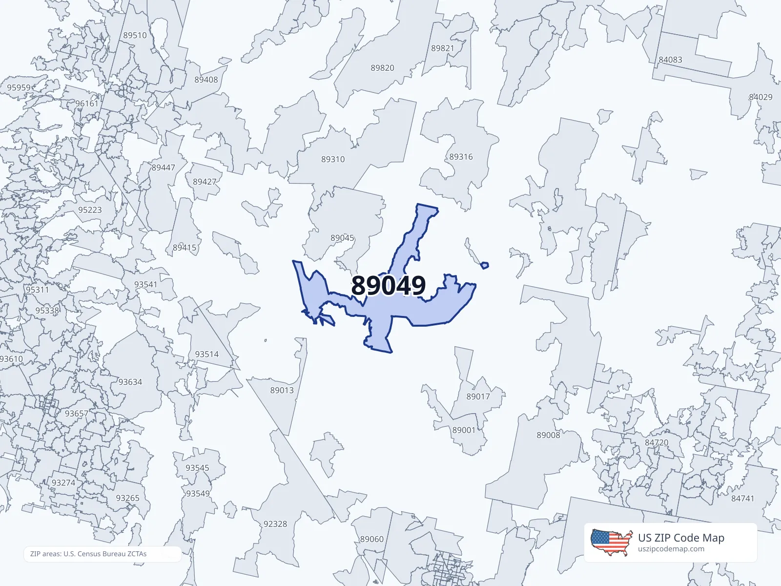
About ZIP code 89049
More enterprise fields
Commercial ZIP directory · not ACS
Commercial ZIP directory population_count for ZCTA 89049. Not ACS. Methodology
People in 89049
Race
- White2,064
- Black or African American59
- American Indian or Alaska Native30
- Asian32
- Native Hawaiian and Pacific Islander5
- Other race88
- Two or more races221
Hispanic or Latino (any race): 266
Age
- Under 10285
- 10 to 19306
- 20 to 29311
- 30 to 39358
- 40 to 49279
- 50 to 59320
- 60 to 69385
- 70 to 79181
- 80 and older74
Income and housing in 89049
Education
- High school graduate90.6%
- Bachelor's degree13.3%
- Graduate degree3.9%
Places covering 89049
Cities and places — Population overlap
Share of this ZIP/ZCTA’s population located within each place, based on ZIP Code Database place-overlap data. This is a population measure, not land-area overlap or the Census-place population.
- Tonopah87.2%
ZIP Code Database place-overlap table, field percent_of_zip_population_in_place, keyed by place_geoid. Not ACS 2019–2023. Overlap vintage is the shipped overlap table and is separate from ACS. Methodology
Counties — Population overlap
Share of this ZIP/ZCTA’s population located within each county, based on ZIP Code Database county-overlap data. This is a population measure, not land-area overlap or the Census county population.
- Nye County99.2%
- Esmeralda County0.8%
ZIP Code Database county-overlap table, field percent_of_zip_population_in_county, keyed by county_geoid. Not ACS 2019–2023. Overlap vintage is the shipped overlap table and is separate from ACS. Methodology
12.8% of this ZIP is outside city limits (a real overlap row, not missing data).
Population history for 89049
Hover the chart or read the table below (Year | ACS | IRS).
| Year | ACS population | IRS population |
|---|---|---|
| 2005 | 2,216 | |
| 2006 | 2,154 | |
| 2007 | 2,411 | |
| 2008 | 2,331 | |
| 2009 | 2,255 | |
| 2010 | 2,269 | |
| 2011 | 3,359 | 2,462 |
| 2012 | 3,212 | 2,260 |
| 2013 | 3,392 | 2,270 |
| 2014 | 3,155 | 2,230 |
| 2015 | 2,870 | 2,210 |
| 2016 | 2,768 | 2,210 |
| 2017 | 2,755 | 2,120 |
| 2018 | 2,554 | 2,100 |
| 2019 | 2,286 | 2,110 |
| 2020 | 2,449 | 2,050 |
| 2021 | 2,496 | 1,980 |
| 2022 | 2,334 | 1,930 |
| 2023 | 2,711 |
ACS: U.S. Census Bureau American Community Survey 5-year estimates. IRS: Statistics of Income ZIP Code data.
ZIP codes near 89049
12 nearest ZIP centroids (any distance)
- 89022Manhattan34.5 miPop 0 · Income —
- 89045Round Mountain50.3 miPop 1,851 · Income $110,651
- 89314Duckwater52.3 miPop 132 · Income $50,313
- 89017Hiko75.0 miPop 9 · Income —
- 89047Silverpeak80.4 miPop 226 · Income $104,821
- 89317Lund82.6 miPop 370 · Income $22,545
- 89310Austin84.8 miPop 173 · Income $48,355
- 89013Goldfield84.9 miPop 234 · Income $120,625
- 89409Gabbs86.9 miPop 158 · Income —
- 89316Eureka90.9 miPop 951 · Income $72,798
- 89001Alamo94.2 miPop 1,045 · Income $85,543
- 89422Mina96.5 miPop 129 · Income $43,295
ZIP centroids within 2 miles
No other ZIP codes within 2 miles of 89049, measured by Census internal-point centroids. Try a wider radius.
ZIPs within 2 miles of this place
Default is 2 miles. Distances are between ZIP centroids. Widen the radius if nothing is in range.
ZIP code 89049 FAQ
- What city is ZIP code 89049 in?
- 89049 is in Tonopah, NV.
- What county is 89049 in?
- 89049 is in Nye County.
- What is the median household income in 89049?
- The median household income in 89049 is $36,570.
- Which ZIP codes are near 89049?
- Use the radius tool on this page to list ZIP codes within a chosen distance of 89049.