
County · GEOID 06025
Imperial County, CA ZIP codes
18 ZIP/ZCTAs intersecting this county.
U.S. Census Bureau, ACS 2019–2023 5-year (vintage 2023). Geography: County Imperial County (GEOID 06025). Methodology
Combined population of ZIP/ZCTAs intersecting this county: 215,720 (18 ZIPs).
Combined population of ZIP/ZCTAs intersecting this county. Each intersecting ZIP contributes its full ZCTA population; overlap percents are descriptive only. This is not the Census county ACS headline above. Methodology
Imperial County, CA ZIP code map
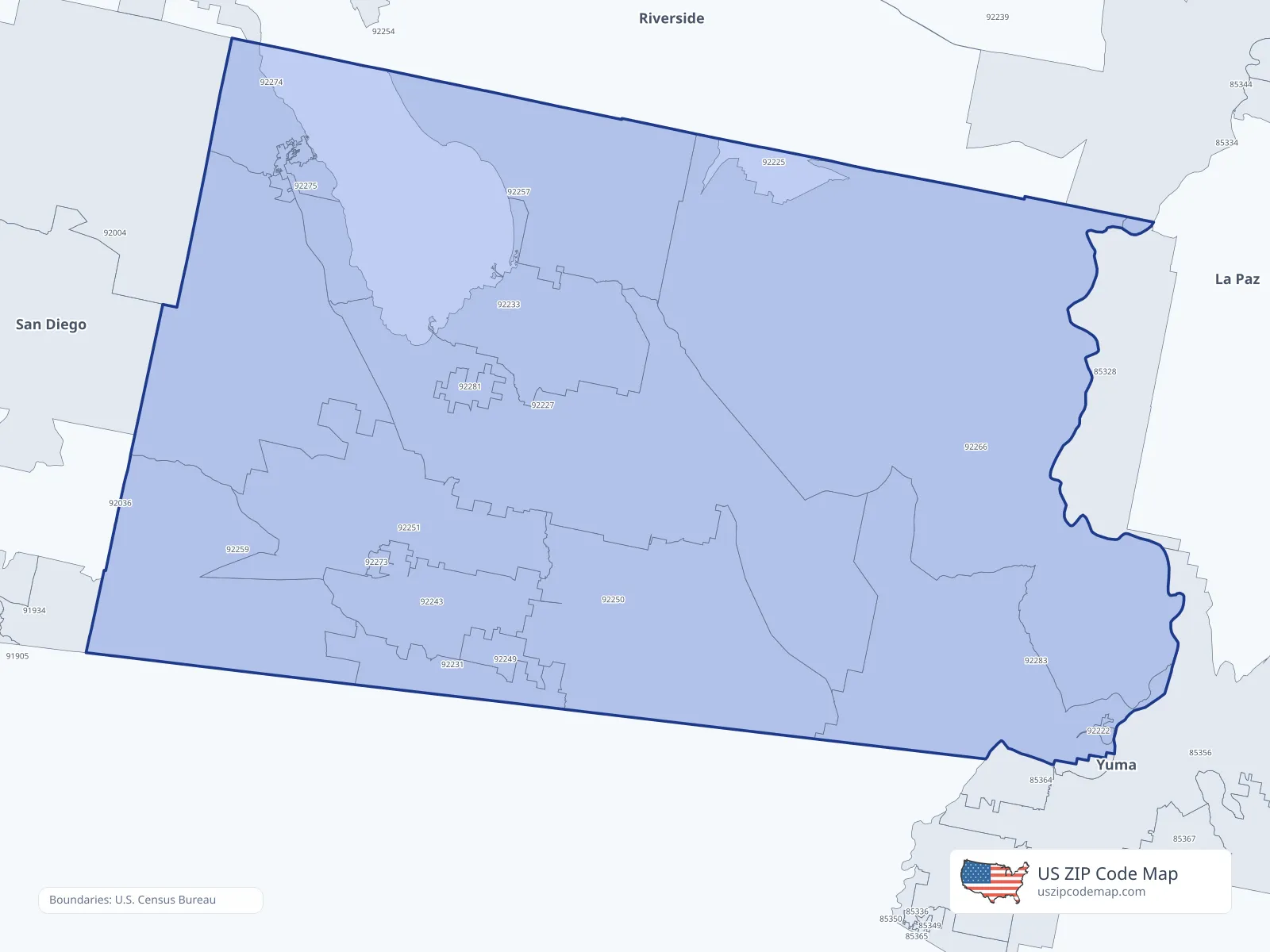
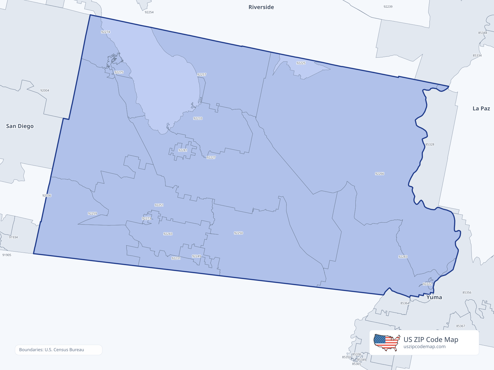
ZIP/ZCTA overlap with Imperial County
Population overlap
Share of each ZIP/ZCTA’s population located within Imperial County, based on ZIP Code Database county-overlap data. This is a population measure, not land-area overlap or the Census county population.
- 920040.1%
- 92222100.0%
Directory county
- 922250.0%
- 92227100.0%
Directory county
- 92231100.0%
Directory county
- 92233100.0%
Directory county
- 92243100.0%
Directory county
- 92249100.0%
Directory county
- 92250100.0%
Directory county
- 92251100.0%
Directory county
- 92257100.0%
Directory county
- 92259100.0%
Directory county
- 92266100.0%
Directory county
- 92273100.0%
Directory county
- 9227429.2%
- 92275100.0%
Directory county
- 92281100.0%
Directory county
- 92283100.0%
Directory county
ZIP Code Database county-overlap table, field percent_of_zip_population_in_county, keyed by county_geoid. Not ACS 2019–2023. Overlap vintage is the shipped overlap table and is separate from ACS. Methodology
ZIP codes intersecting Imperial County
| ZIP | City | County | Population | Income |
|---|---|---|---|---|
| 92004 | Borrego Springs | San Diego County | 3,030 | $71,582 |
| 92222 | Bard | Imperial County | 0 | — |
| 92225 | Blythe | Riverside County | 21,101 | $51,294 |
| 92227 | Brawley | Imperial County | 28,147 | $60,593 |
| 92231 | Calexico | Imperial County | 38,547 | $50,114 |
| 92233 | Calipatria | Imperial County | 6,837 | $53,282 |
| 92243 | El Centro | Imperial County | 48,556 | $55,890 |
| 92249 | Heber | Imperial County | 7,308 | $75,664 |
| 92250 | Holtville | Imperial County | 7,854 | $70,250 |
| 92251 | Imperial | Imperial County | 27,197 | $83,709 |
| 92257 | Niland | Imperial County | 2,185 | $17,663 |
| 92259 | Ocotillo | Imperial County | 237 | — |
| 92266 | Palo Verde | Imperial County | 152 | $20,870 |
| 92273 | Seeley | Imperial County | 1,551 | $55,167 |
| 92274 | Thermal | Riverside County | 17,909 | $36,087 |
| 92275 | Salton City | Imperial County | 1,410 | $35,658 |
| 92281 | Westmorland | Imperial County | 1,904 | $35,882 |
| 92283 | Winterhaven | Imperial County | 1,795 | $38,359 |
USPS associates these ZIPs with Imperial County
These codes list Imperial County as a primary or acceptable city. They are not used for the ACS headline.
| ZIP | City | County | Population | Income |
|---|---|---|---|---|
| 92232 | Calexico | Imperial County | 5,047 | — |
| 92244 | El Centro | Imperial County | 2,764 | — |