
County · GEOID 06027
Inyo County, CA ZIP codes
14 ZIP/ZCTAs intersecting this county.
U.S. Census Bureau, ACS 2019–2023 5-year (vintage 2023). Geography: County Inyo County (GEOID 06027). Methodology
Combined population of ZIP/ZCTAs intersecting this county: 44,964 (14 ZIPs).
Combined population of ZIP/ZCTAs intersecting this county. Each intersecting ZIP contributes its full ZCTA population; overlap percents are descriptive only. This is not the Census county ACS headline above. Methodology
Inyo County, CA ZIP code map
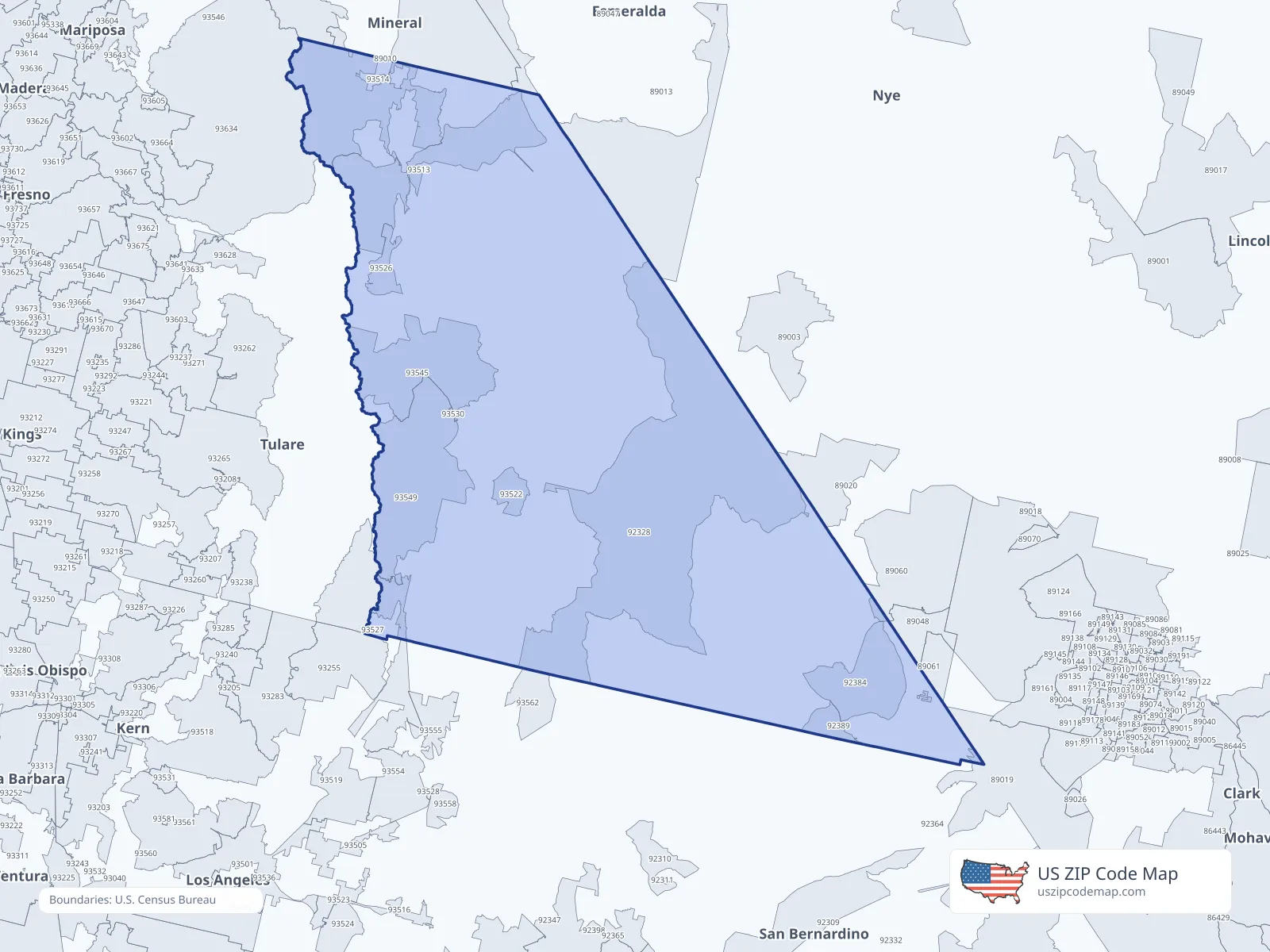
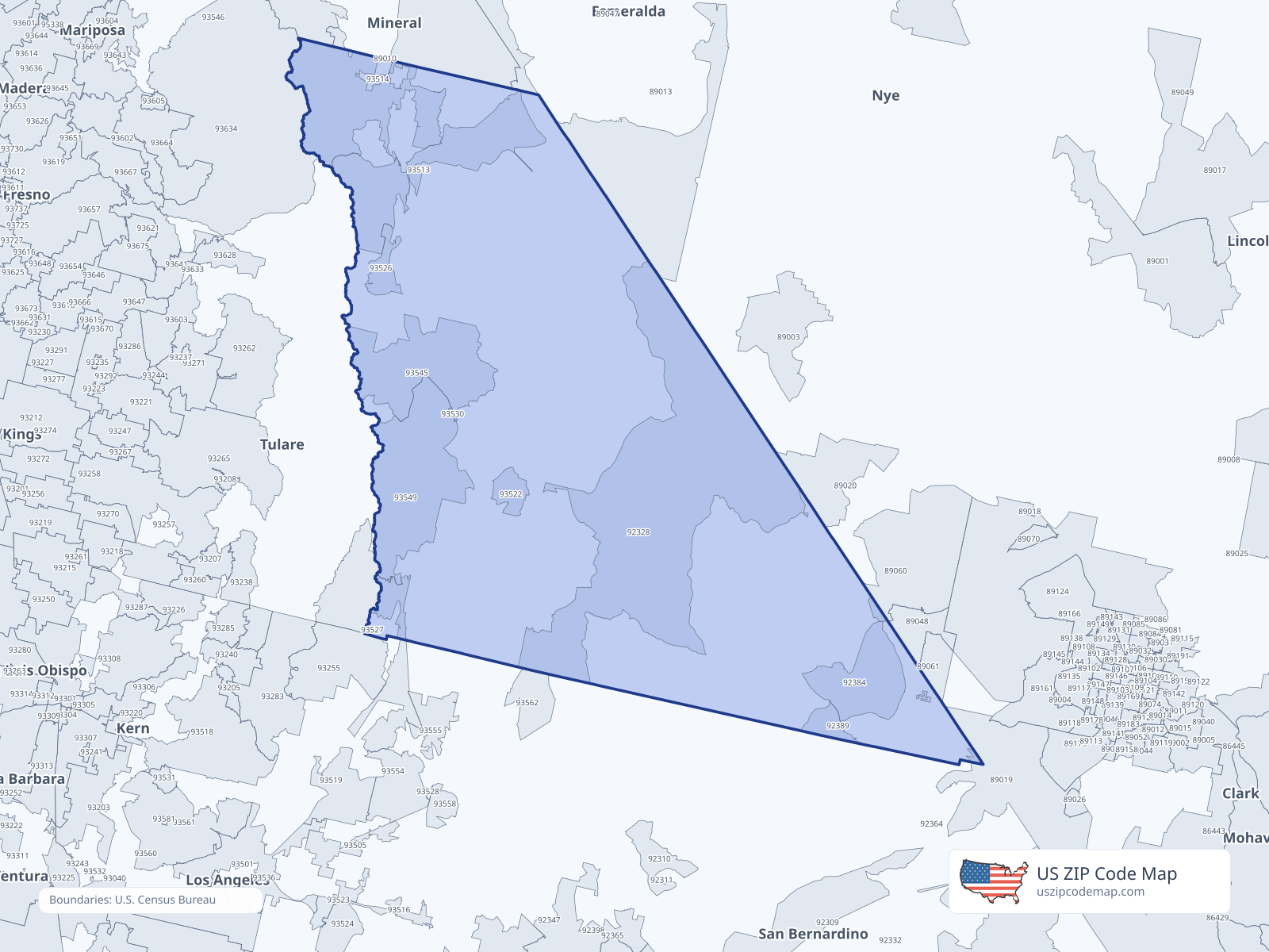
ZIP/ZCTA overlap with Inyo County
Population overlap
Share of each ZIP/ZCTA’s population located within Inyo County, based on ZIP Code Database county-overlap data. This is a population measure, not land-area overlap or the Census county population.
- 890190.2%
- 890600.3%
- 890610.7%
- 92328100.0%
Directory county
- 92384100.0%
Directory county
- 92389100.0%
Directory county
- 93513100.0%
Directory county
- 9351491.6%
Directory county
- 93522100.0%
Directory county
- 93526100.0%
Directory county
- 935270.5%
- 93530100.0%
Directory county
- 93545100.0%
Directory county
- 93549100.0%
Directory county
ZIP Code Database county-overlap table, field percent_of_zip_population_in_county, keyed by county_geoid. Not ACS 2019–2023. Overlap vintage is the shipped overlap table and is separate from ACS. Methodology
ZIP codes intersecting Inyo County
| ZIP | City | County | Population | Income |
|---|---|---|---|---|
| 89019 | Jean | Clark County | 2,355 | $50,106 |
| 89060 | Pahrump | Nye County | 12,783 | $49,008 |
| 89061 | Pahrump | Nye County | 7,835 | $69,609 |
| 92328 | Death Valley | Inyo County | 872 | $91,198 |
| 92384 | Shoshone | Inyo County | 18 | — |
| 92389 | Tecopa | Inyo County | 169 | $26,731 |
| 93513 | Big Pine | Inyo County | 1,525 | $54,485 |
| 93514 | Bishop | Inyo County | 14,961 | $81,695 |
| 93522 | Darwin | Inyo County | 74 | — |
| 93526 | Independence | Inyo County | 912 | $61,563 |
| 93527 | Inyokern | Kern County | 1,801 | $82,667 |
| 93530 | Keeler | Inyo County | 21 | — |
| 93545 | Lone Pine | Inyo County | 1,394 | $49,635 |
| 93549 | Olancha | Inyo County | 244 | $73,125 |
USPS associates these ZIPs with Inyo County
These codes list Inyo County as a primary or acceptable city. They are not used for the ACS headline.
| ZIP | City | County | Population | Income |
|---|---|---|---|---|
| 93515 | Bishop | Inyo County | 1,178 | — |
| 93542 | Little Lake | Inyo County | — | — |
| 93592 | Trona | Inyo County | 316 | — |