
County · GEOID 06043
Mariposa County, CA ZIP codes
13 ZIP/ZCTAs intersecting this county.
U.S. Census Bureau, ACS 2019–2023 5-year (vintage 2023). Geography: County Mariposa County (GEOID 06043). Methodology
Combined population of ZIP/ZCTAs intersecting this county: 25,849 (13 ZIPs).
Combined population of ZIP/ZCTAs intersecting this county. Each intersecting ZIP contributes its full ZCTA population; overlap percents are descriptive only. This is not the Census county ACS headline above. Methodology
Mariposa County, CA ZIP code map
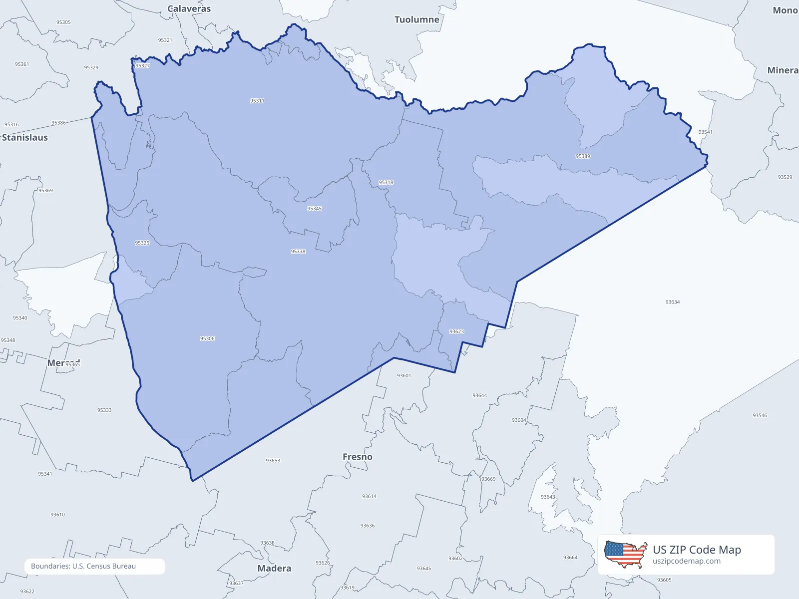
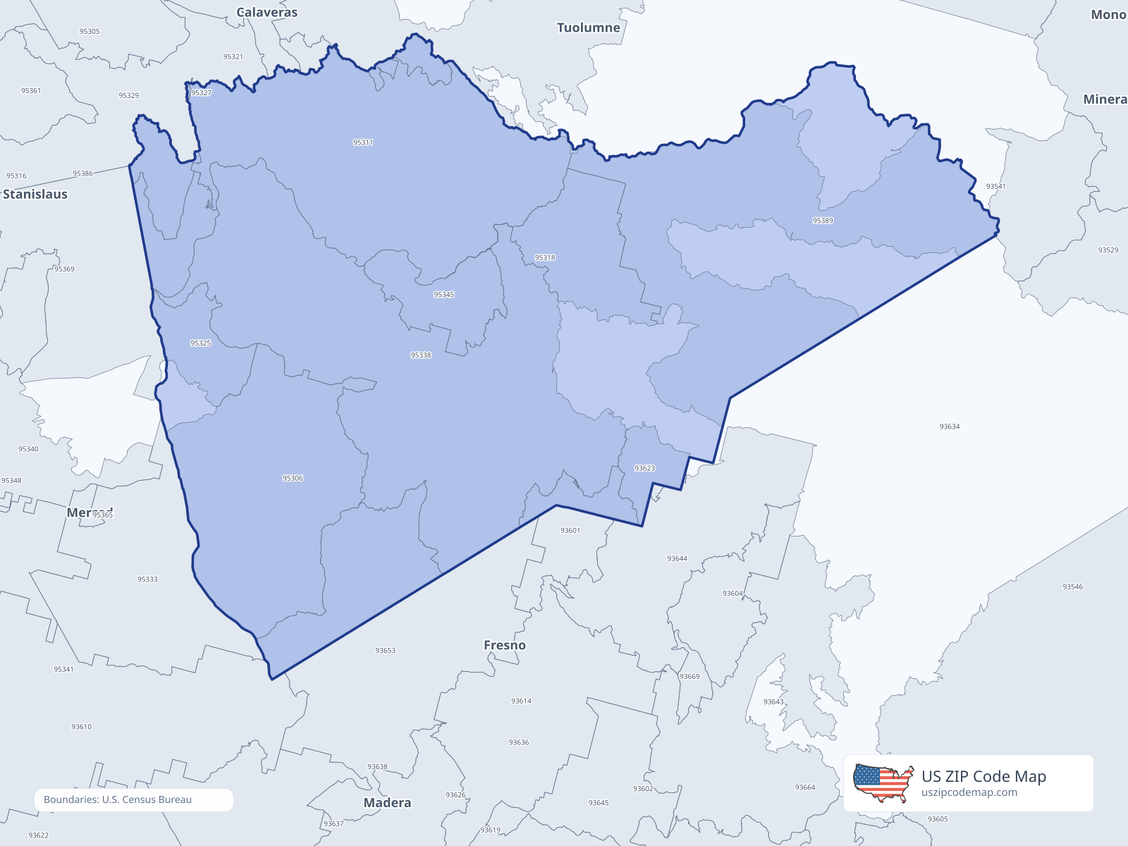
ZIP/ZCTA overlap with Mariposa County
Population overlap
Share of each ZIP/ZCTA’s population located within Mariposa County, based on ZIP Code Database county-overlap data. This is a population measure, not land-area overlap or the Census county population.
- 936016.7%
- 9362392.0%
Directory county
- 936538.8%
- 95306100.0%
Directory county
- 9531196.3%
Directory county
- 95318100.0%
Directory county
- 953211.6%
- 95325100.0%
Directory county
- 9532942.5%
- 95338100.0%
Directory county
- 95345100.0%
Directory county
- 953696.7%
- 9538999.5%
Directory county
ZIP Code Database county-overlap table, field percent_of_zip_population_in_county, keyed by county_geoid. Not ACS 2019–2023. Overlap vintage is the shipped overlap table and is separate from ACS. Methodology
ZIP codes intersecting Mariposa County
| ZIP | City | County | Population | Income |
|---|---|---|---|---|
| 93601 | Ahwahnee | Madera County | 1,248 | $76,429 |
| 93623 | Fish Camp | Mariposa County | 4 | — |
| 93653 | Raymond | Madera County | 1,314 | $103,750 |
| 95306 | Catheys Valley | Mariposa County | 869 | $77,724 |
| 95311 | Coulterville | Mariposa County | 2,282 | $70,469 |
| 95318 | El Portal | Mariposa County | 572 | $54,430 |
| 95321 | Groveland | Tuolumne County | 3,870 | $69,679 |
| 95325 | Hornitos | Mariposa County | 0 | — |
| 95329 | La Grange | Tuolumne County | 2,339 | $74,924 |
| 95338 | Mariposa | Mariposa County | 10,164 | $64,707 |
| 95345 | Midpines | Mariposa County | 318 | $65,221 |
| 95369 | Snelling | Merced County | 802 | $86,250 |
| 95389 | Yosemite National Park | Mariposa County | 2,067 | $44,962 |