
Census place · GEOID 0675000 · San Joaquin County
Stockton, CA ZIP codes
14 ZIP/ZCTAs intersecting this Census place in San Joaquin County.
U.S. Census Bureau, ACS 2019–2023 5-year (vintage 2023). Geography: Census place Stockton (GEOID 0675000). Methodology
Combined population of ZIP/ZCTAs intersecting this place: 441,979 (14 ZIPs).
Combined population of ZIP/ZCTAs intersecting this place. Each intersecting ZIP contributes its full ZCTA population; overlap percents are descriptive only. This is not the Census place ACS headline above. Methodology
Map of Stockton, CA
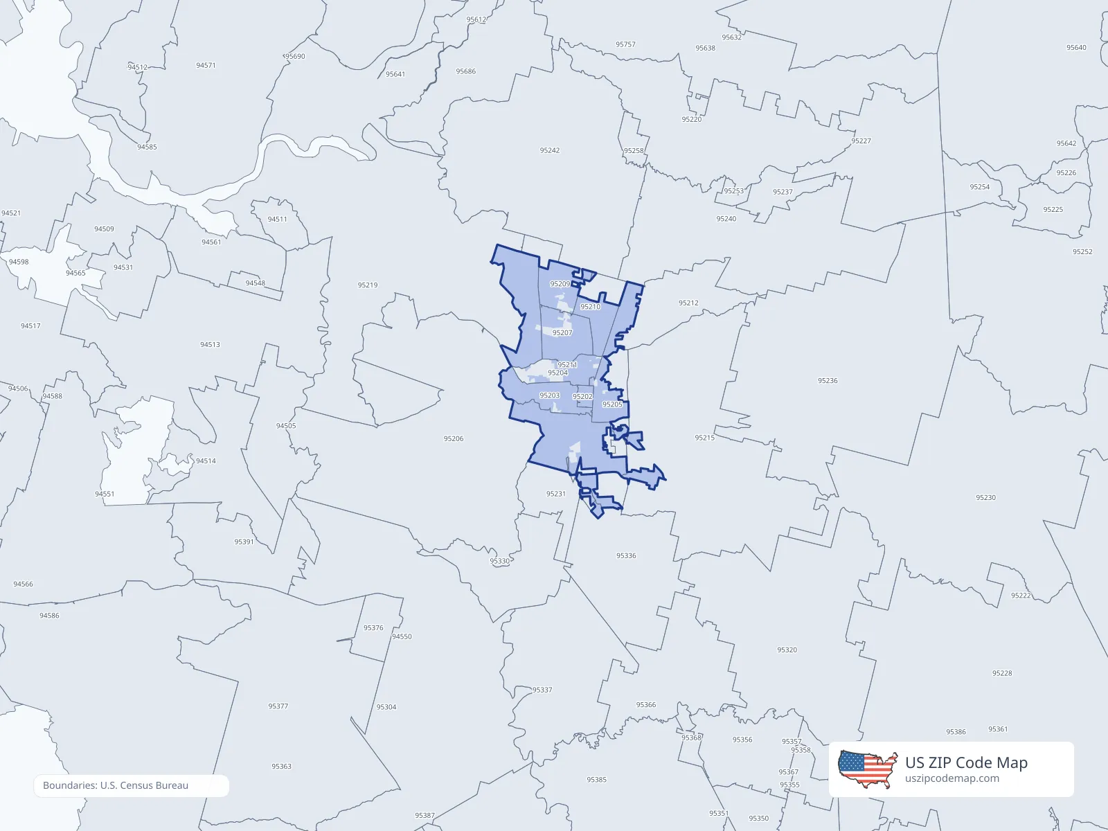
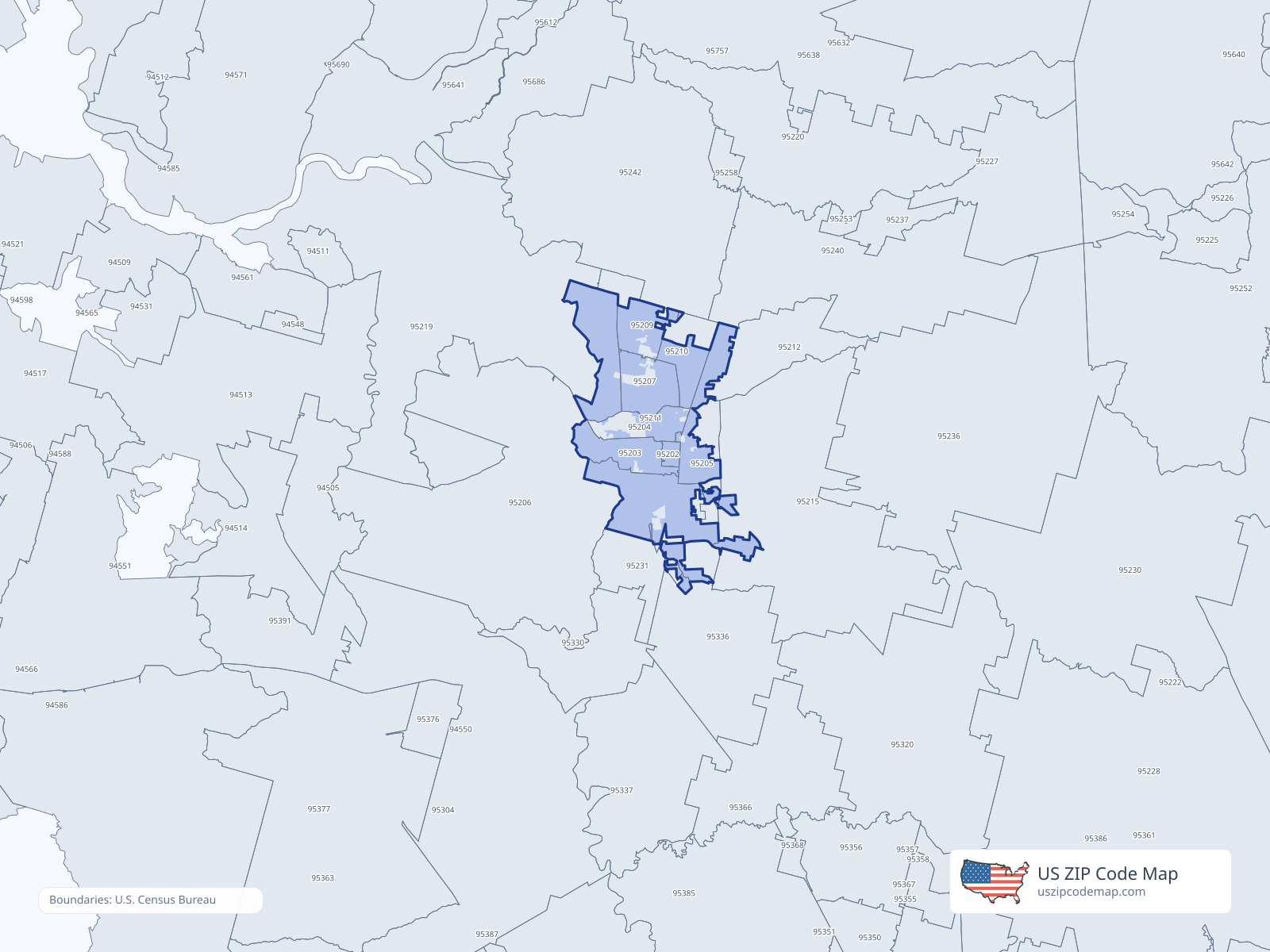
ZIP/ZCTA overlap with Stockton
Population overlap
Share of each ZIP/ZCTA’s population located within Stockton, based on ZIP Code Database place-overlap data. This is a population measure, not land-area overlap or the Census-place population.
- 95202100.0%
USPS primary city
- 9520394.8%
USPS primary city
- 9520462.9%
USPS primary city
- 9520571.1%
USPS primary city
- 9520691.6%
USPS primary city
- 9520790.8%
USPS primary city
- 9520994.8%
USPS primary city
- 9521099.8%
USPS primary city
- 95211100.0%
USPS primary city
- 9521277.5%
USPS primary city
- 952150.5%
USPS primary city
- 9521996.5%
USPS primary city
- 952310.6%
- 953360.0%
ZIP Code Database place-overlap table, field percent_of_zip_population_in_place, keyed by place_geoid. Not ACS 2019–2023. Overlap vintage is the shipped overlap table and is separate from ACS. Methodology
ZIP codes intersecting Stockton
| ZIP | City | County | Population | Income |
|---|---|---|---|---|
| 95202 | Stockton | San Joaquin County | 6,426 | $23,954 |
| 95203 | Stockton | San Joaquin County | 16,628 | $64,710 |
| 95204 | Stockton | San Joaquin County | 31,028 | $71,792 |
| 95205 | Stockton | San Joaquin County | 39,154 | $58,138 |
| 95206 | Stockton | San Joaquin County | 67,501 | $79,751 |
| 95207 | Stockton | San Joaquin County | 52,441 | $68,767 |
| 95209 | Stockton | San Joaquin County | 46,567 | $106,056 |
| 95210 | Stockton | San Joaquin County | 42,103 | $65,411 |
| 95211 | Stockton | San Joaquin County | 1,190 | — |
| 95212 | Stockton | San Joaquin County | 28,013 | $104,078 |
| 95215 | Stockton | San Joaquin County | 26,032 | $68,189 |
| 95219 | Stockton | San Joaquin County | 31,200 | $105,300 |
| 95231 | French Camp | San Joaquin County | 4,339 | $73,292 |
| 95336 | Manteca | San Joaquin County | 49,357 | $86,411 |
USPS associates these ZIPs with Stockton
These codes list Stockton as a primary or acceptable city. They are not used for the ACS headline.
| ZIP | City | County | Population | Income |
|---|---|---|---|---|
| 95201 | Stockton | San Joaquin County | 1,195 | — |
| 95208 | Stockton | San Joaquin County | 967 | — |
| 95213 | Stockton | San Joaquin County | 1,145 | — |
| 95214 | Stockton | — | — | — |
| 95267 | Stockton | San Joaquin County | 830 | — |
| 95269 | Stockton | San Joaquin County | 2,067 | — |
| 95296 | Stockton | San Joaquin County | — | — |
| 95297 | Stockton | San Joaquin County | — | — |