
County · GEOID 17029
Coles County, IL ZIP codes
16 ZIP/ZCTAs intersecting this county.
U.S. Census Bureau, ACS 2019–2023 5-year (vintage 2023). Geography: County Coles County (GEOID 17029). Methodology
Combined population of ZIP/ZCTAs intersecting this county: 74,650 (16 ZIPs).
Combined population of ZIP/ZCTAs intersecting this county. Each intersecting ZIP contributes its full ZCTA population; overlap percents are descriptive only. This is not the Census county ACS headline above. Methodology
Coles County, IL ZIP code map
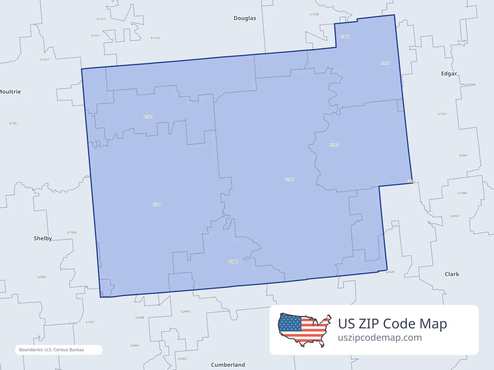
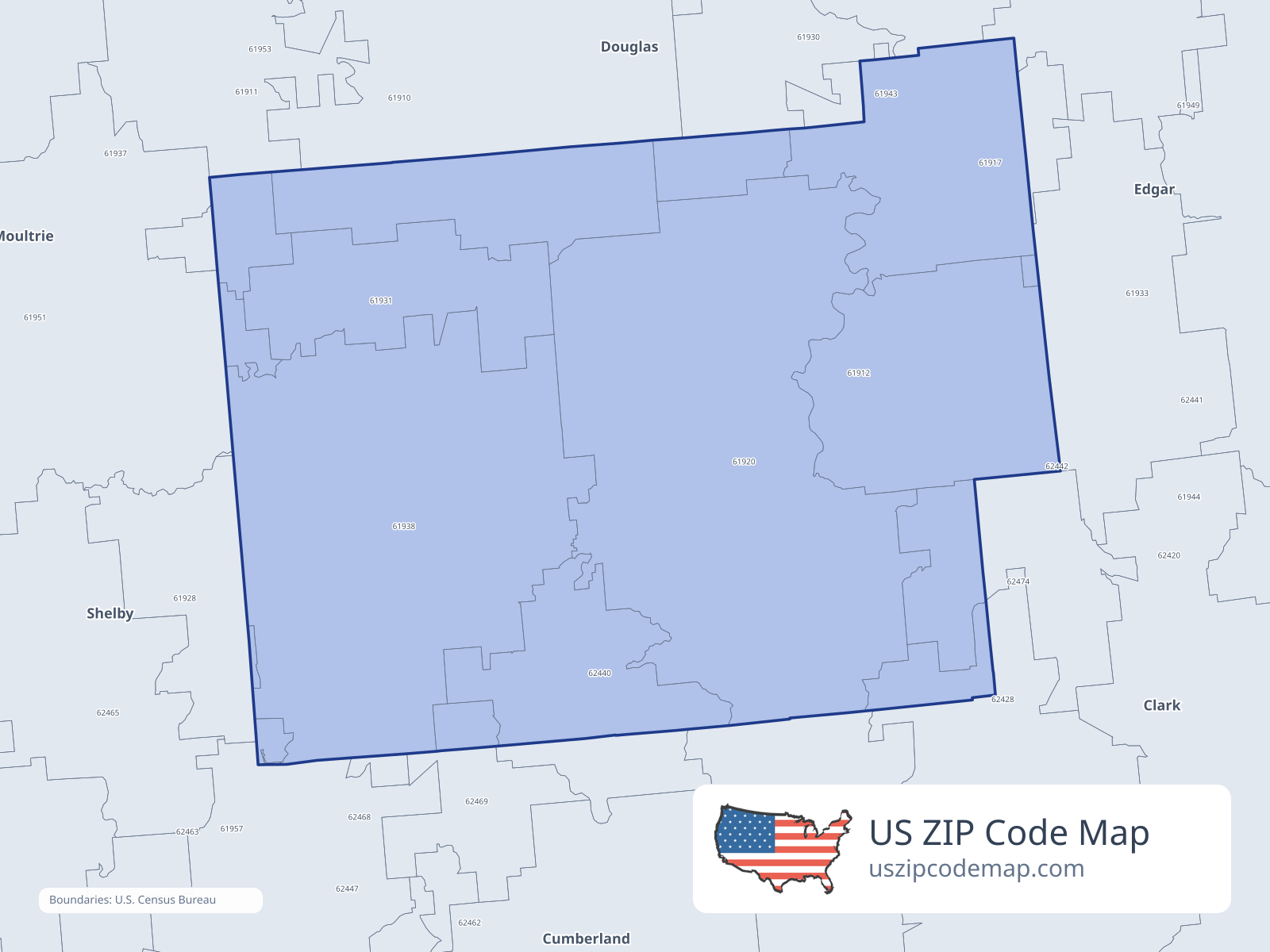
ZIP/ZCTA overlap with Coles County
Population overlap
Share of each ZIP/ZCTA’s population located within Coles County, based on ZIP Code Database county-overlap data. This is a population measure, not land-area overlap or the Census county population.
- 619106.5%
- 619111.0%
- 61912100.0%
Directory county
- 61920100.0%
Directory county
- 6192821.1%
- 619306.8%
- 61931100.0%
Directory county
- 619330.5%
- 6193899.9%
Directory county
- 6194387.8%
Directory county
- 619510.5%
- 624201.2%
- 6244078.9%
Directory county
- 624470.7%
- 6246937.9%
- 6247414.3%
ZIP Code Database county-overlap table, field percent_of_zip_population_in_county, keyed by county_geoid. Not ACS 2019–2023. Overlap vintage is the shipped overlap table and is separate from ACS. Methodology
ZIP codes intersecting Coles County
| ZIP | City | County | Population | Income |
|---|---|---|---|---|
| 61910 | Arcola | Douglas County | 4,910 | $83,173 |
| 61911 | Arthur | Douglas County | 4,484 | $76,960 |
| 61912 | Ashmore | Coles County | 1,192 | $73,542 |
| 61920 | Charleston | Coles County | 20,703 | $54,229 |
| 61928 | Gays | Moultrie County | 782 | $115,291 |
| 61930 | Hindsboro | Douglas County | 708 | $77,250 |
| 61931 | Humboldt | Coles County | 1,328 | $70,086 |
| 61933 | Kansas | Edgar County | 1,227 | $65,993 |
| 61938 | Mattoon | Coles County | 20,440 | $54,288 |
| 61943 | Oakland | Coles County | 1,495 | $57,500 |
| 61951 | Sullivan | Moultrie County | 7,654 | $75,234 |
| 62420 | Casey | Clark County | 4,361 | $68,235 |
| 62440 | Lerna | Coles County | 1,092 | $72,583 |
| 62447 | Neoga | Cumberland County | 3,195 | $84,158 |
| 62469 | Trilla | Cumberland County | 428 | $113,512 |
| 62474 | Westfield | Clark County | 651 | $64,861 |
USPS associates these ZIPs with Coles County
These codes list Coles County as a primary or acceptable city. They are not used for the ACS headline.
| ZIP | City | County | Population | Income |
|---|---|---|---|---|
| 62435 | Janesville | Coles County | 65 | — |