
County · GEOID 17063
Grundy County, IL ZIP codes
16 ZIP/ZCTAs intersecting this county.
U.S. Census Bureau, ACS 2019–2023 5-year (vintage 2023). Geography: County Grundy County (GEOID 17063). Methodology
Combined population of ZIP/ZCTAs intersecting this county: 91,546 (16 ZIPs).
Combined population of ZIP/ZCTAs intersecting this county. Each intersecting ZIP contributes its full ZCTA population; overlap percents are descriptive only. This is not the Census county ACS headline above. Methodology
Grundy County, IL ZIP code map
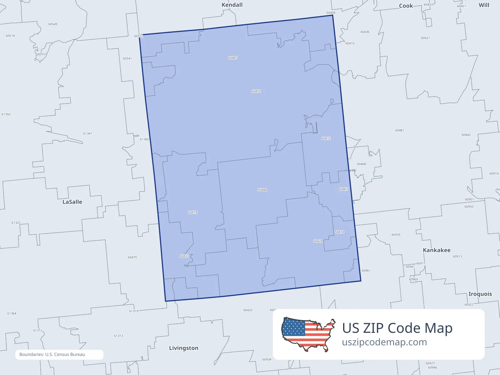
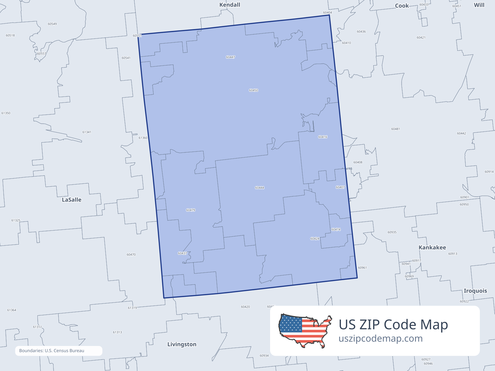
ZIP/ZCTA overlap with Grundy County
Population overlap
Share of each ZIP/ZCTA’s population located within Grundy County, based on ZIP Code Database county-overlap data. This is a population measure, not land-area overlap or the Census county population.
- 6040764.6%
Directory county
- 6041030.6%
- 6041699.9%
Directory county
- 604204.7%
- 6042499.7%
Directory county
- 60437100.0%
Directory county
- 60444100.0%
Directory county
- 6044768.5%
Directory county
- 6045099.6%
Directory county
- 604701.9%
- 60474100.0%
Directory county
- 60479100.0%
Directory county
- 604812.1%
- 605414.6%
- 609613.5%
- 613603.8%
ZIP Code Database county-overlap table, field percent_of_zip_population_in_county, keyed by county_geoid. Not ACS 2019–2023. Overlap vintage is the shipped overlap table and is separate from ACS. Methodology
ZIP codes intersecting Grundy County
| ZIP | City | County | Population | Income |
|---|---|---|---|---|
| 60407 | Braceville | Grundy County | 1,723 | $81,750 |
| 60410 | Channahon | Will County | 14,027 | $120,278 |
| 60416 | Coal City | Grundy County | 9,277 | $71,865 |
| 60420 | Dwight | Livingston County | 4,672 | $68,184 |
| 60424 | Gardner | Grundy County | 2,170 | $81,000 |
| 60437 | Kinsman | Grundy County | 103 | $75,625 |
| 60444 | Mazon | Grundy County | 1,986 | $88,750 |
| 60447 | Minooka | Grundy County | 16,099 | $115,039 |
| 60450 | Morris | Grundy County | 20,918 | $81,716 |
| 60470 | Ransom | LaSalle County | 410 | $68,500 |
| 60474 | South Wilmington | Grundy County | 628 | $86,250 |
| 60479 | Verona | Grundy County | 629 | $103,333 |
| 60481 | Wilmington | Will County | 11,277 | $76,398 |
| 60541 | Newark | Kendall County | 3,379 | $119,063 |
| 60961 | Reddick | Kankakee County | 928 | $61,193 |
| 61360 | Seneca | LaSalle County | 3,320 | $94,137 |