
County · GEOID 17085
Jo Daviess County, IL ZIP codes
15 ZIP/ZCTAs intersecting this county.
U.S. Census Bureau, ACS 2019–2023 5-year (vintage 2023). Geography: County Jo Daviess County (GEOID 17085). Methodology
Combined population of ZIP/ZCTAs intersecting this county: 34,957 (15 ZIPs).
Combined population of ZIP/ZCTAs intersecting this county. Each intersecting ZIP contributes its full ZCTA population; overlap percents are descriptive only. This is not the Census county ACS headline above. Methodology
Jo Daviess County, IL ZIP code map
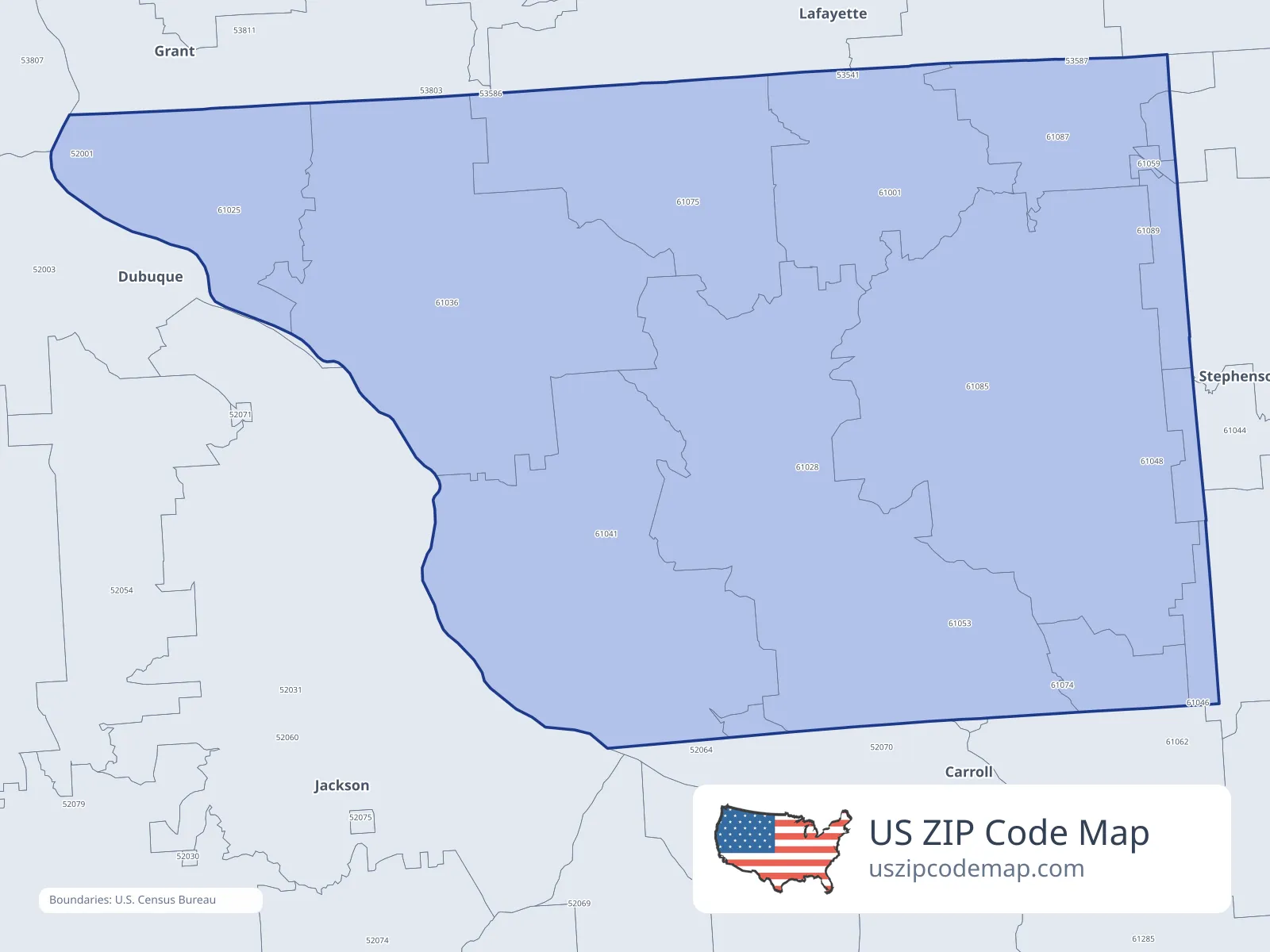
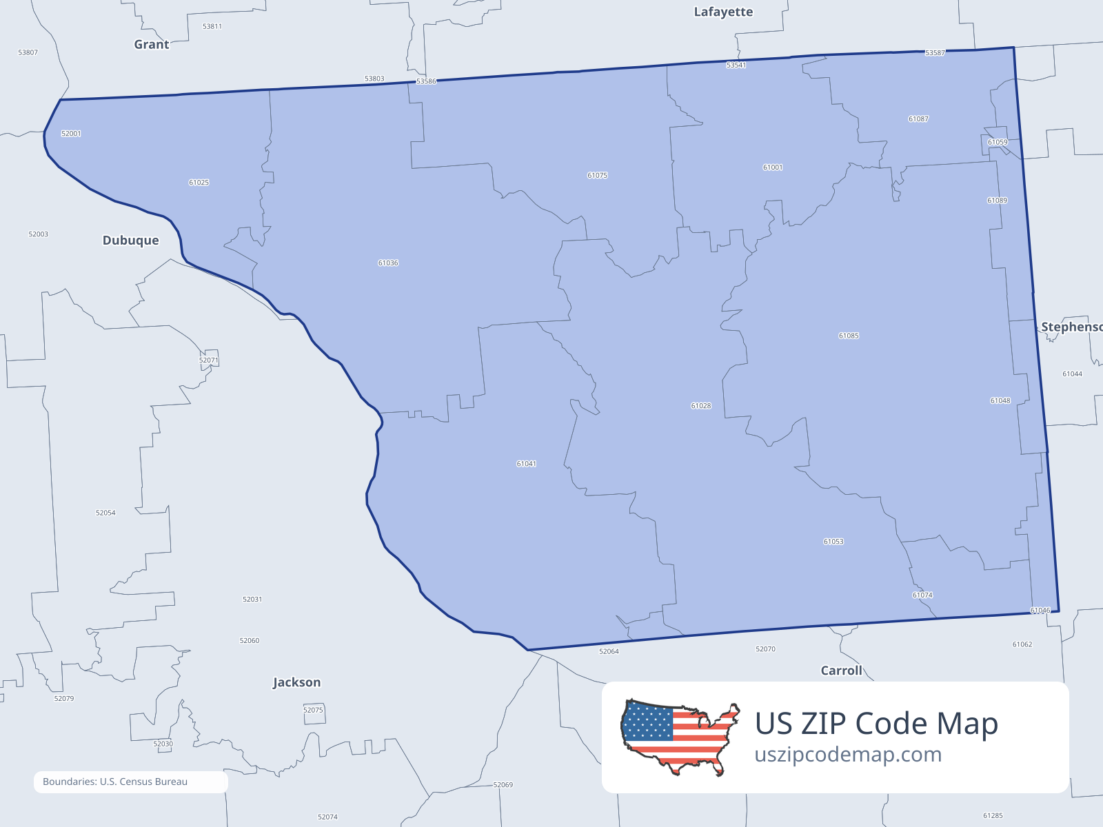
ZIP/ZCTA overlap with Jo Daviess County
Population overlap
Share of each ZIP/ZCTA’s population located within Jo Daviess County, based on ZIP Code Database county-overlap data. This is a population measure, not land-area overlap or the Census county population.
- 61001100.0%
Directory county
- 61025100.0%
Directory county
- 61028100.0%
Directory county
- 61036100.0%
Directory county
- 61041100.0%
Directory county
- 6104418.2%
- 610481.5%
- 610532.6%
- 61059100.0%
Directory county
- 610621.3%
- 610740.3%
- 61075100.0%
Directory county
- 61085100.0%
Directory county
- 6108799.8%
Directory county
- 610891.6%
ZIP Code Database county-overlap table, field percent_of_zip_population_in_county, keyed by county_geoid. Not ACS 2019–2023. Overlap vintage is the shipped overlap table and is separate from ACS. Methodology
ZIP codes intersecting Jo Daviess County
| ZIP | City | County | Population | Income |
|---|---|---|---|---|
| 61001 | Apple River | Jo Daviess County | 1,237 | $75,833 |
| 61025 | East Dubuque | Jo Daviess County | 4,331 | $84,177 |
| 61028 | Elizabeth | Jo Daviess County | 1,671 | $86,328 |
| 61036 | Galena | Jo Daviess County | 7,014 | $80,574 |
| 61041 | Hanover | Jo Daviess County | 1,428 | $44,464 |
| 61044 | Kent | Stephenson County | 276 | $56,307 |
| 61048 | Lena | Stephenson County | 3,848 | $87,604 |
| 61053 | Mount Carroll | Carroll County | 2,902 | $61,932 |
| 61059 | Nora | Jo Daviess County | 176 | $52,155 |
| 61062 | Pearl City | Stephenson County | 1,881 | $78,929 |
| 61074 | Savanna | Carroll County | 4,009 | $48,387 |
| 61075 | Scales Mound | Jo Daviess County | 997 | $77,734 |
| 61085 | Stockton | Jo Daviess County | 2,946 | $59,612 |
| 61087 | Warren | Jo Daviess County | 1,648 | $74,609 |
| 61089 | Winslow | Stephenson County | 593 | $68,846 |