
Census place · GEOID 2646000 · Ingham County
Lansing, MI ZIP codes
12 ZIP/ZCTAs intersecting this Census place in Ingham County.
U.S. Census Bureau, ACS 2019–2023 5-year (vintage 2023). Geography: Census place Lansing (GEOID 2646000). Methodology
Combined population of ZIP/ZCTAs intersecting this place: 294,915 (12 ZIPs).
Combined population of ZIP/ZCTAs intersecting this place. Each intersecting ZIP contributes its full ZCTA population; overlap percents are descriptive only. This is not the Census place ACS headline above. Methodology
Map of Lansing, MI
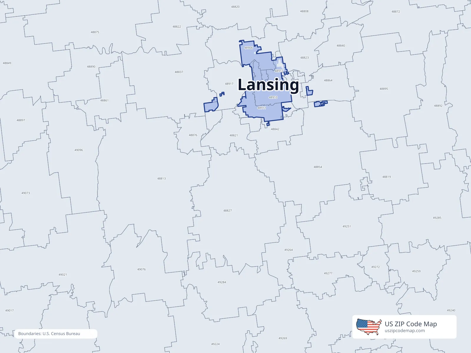
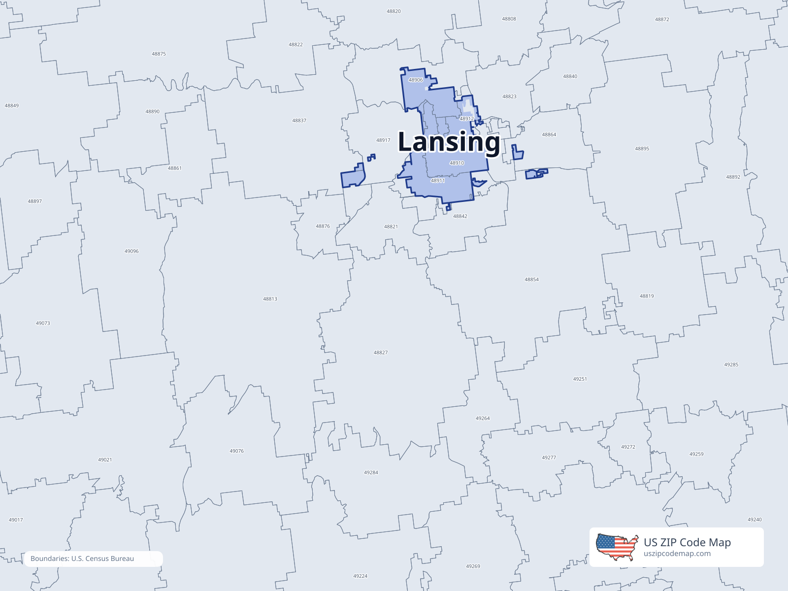
ZIP/ZCTA overlap with Lansing
Population overlap
Share of each ZIP/ZCTA’s population located within Lansing, based on ZIP Code Database place-overlap data. This is a population measure, not land-area overlap or the Census-place population.
- 488230.0%
- 488370.0%
- 488420.5%
- 488540.0%
- 488642.7%
- 4890666.0%
USPS primary city
- 48910100.0%
USPS primary city
- 4891186.9%
USPS primary city
- 4891282.9%
USPS primary city
- 48915100.0%
USPS primary city
- 489170.4%
USPS primary city
- 48933100.0%
USPS primary city
ZIP Code Database place-overlap table, field percent_of_zip_population_in_place, keyed by place_geoid. Not ACS 2019–2023. Overlap vintage is the shipped overlap table and is separate from ACS. Methodology
ZIP codes intersecting Lansing
| ZIP | City | County | Population | Income |
|---|---|---|---|---|
| 48823 | East Lansing | Ingham County | 49,379 | $50,837 |
| 48837 | Grand Ledge | Eaton County | 19,822 | $93,161 |
| 48842 | Holt | Ingham County | 21,504 | $86,830 |
| 48854 | Mason | Ingham County | 19,403 | $91,956 |
| 48864 | Okemos | Ingham County | 23,548 | $113,145 |
| 48906 | Lansing | Ingham County | 25,960 | $61,533 |
| 48910 | Lansing | Ingham County | 32,801 | $52,154 |
| 48911 | Lansing | Ingham County | 40,407 | $54,882 |
| 48912 | Lansing | Ingham County | 17,398 | $53,072 |
| 48915 | Lansing | Ingham County | 9,315 | $51,653 |
| 48917 | Lansing | Eaton County | 32,029 | $73,259 |
| 48933 | Lansing | Ingham County | 3,349 | $36,895 |
USPS associates these ZIPs with Lansing
These codes list Lansing as a primary or acceptable city. They are not used for the ACS headline.