
County · GEOID 42083
McKean County, PA ZIP codes
22 ZIP/ZCTAs intersecting this county.
U.S. Census Bureau, ACS 2019–2023 5-year (vintage 2023). Geography: County McKean County (GEOID 42083). Methodology
Combined population of ZIP/ZCTAs intersecting this county: 44,922 (22 ZIPs).
Combined population of ZIP/ZCTAs intersecting this county. Each intersecting ZIP contributes its full ZCTA population; overlap percents are descriptive only. This is not the Census county ACS headline above. Methodology
McKean County, PA ZIP code map
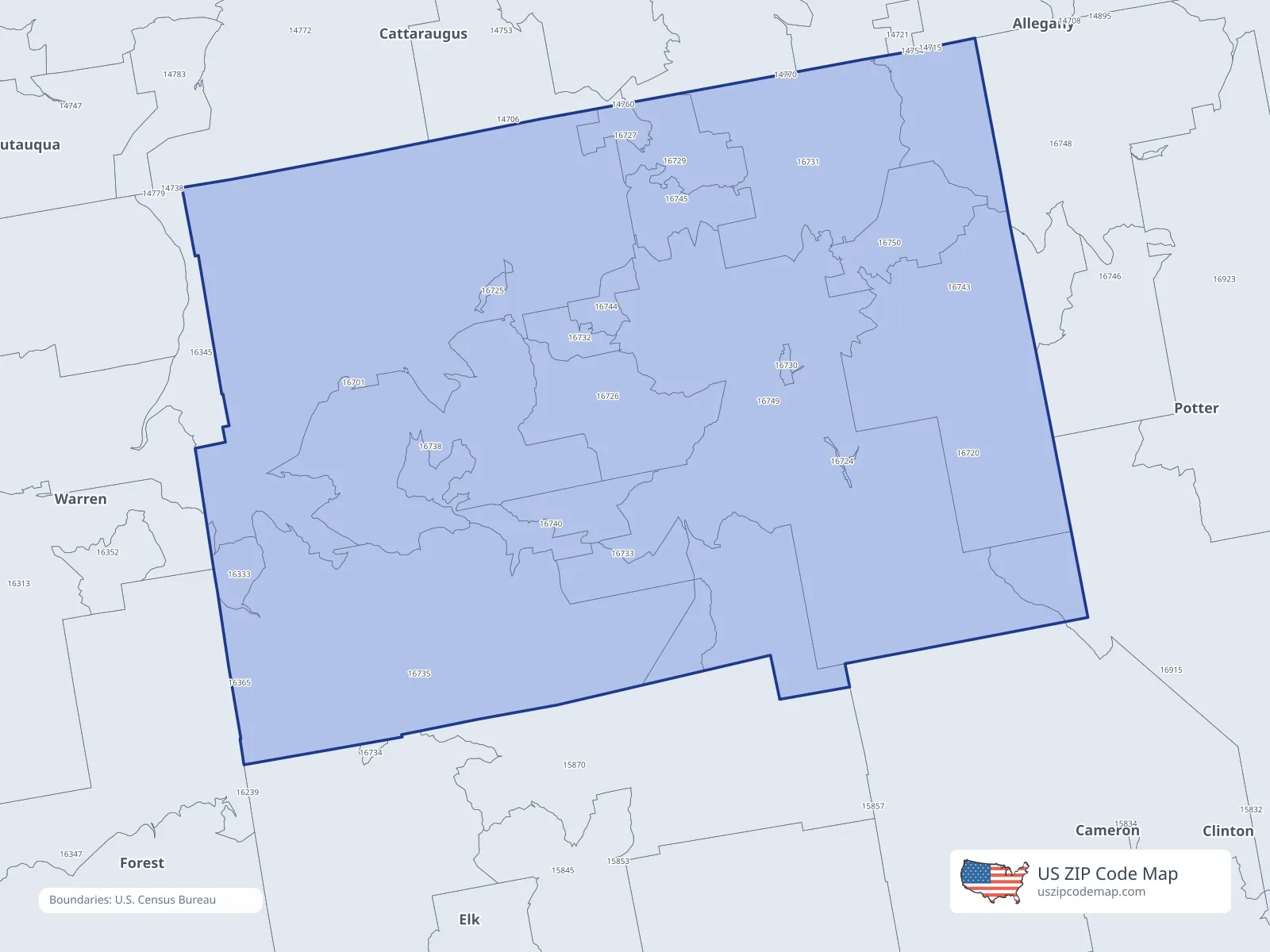
ZIP/ZCTA overlap with McKean County
Population overlap
Share of each ZIP/ZCTA’s population located within McKean County, based on ZIP Code Database county-overlap data. This is a population measure, not land-area overlap or the Census county population.
- 158701.9%
- 16333100.0%
Directory county
- 1670199.8%
Directory county
- 167202.8%
- 16724100.0%
Directory county
- 16725100.0%
Directory county
- 16726100.0%
Directory county
- 16727100.0%
Directory county
- 16729100.0%
Directory county
- 16730100.0%
Directory county
- 16731100.0%
Directory county
- 16732100.0%
Directory county
- 16733100.0%
Directory county
- 1673595.0%
Directory county
- 16738100.0%
Directory county
- 16740100.0%
Directory county
- 1674397.2%
Directory county
- 16744100.0%
Directory county
- 16745100.0%
Directory county
- 1674821.7%
- 16749100.0%
Directory county
- 16750100.0%
Directory county
ZIP Code Database county-overlap table, field percent_of_zip_population_in_county, keyed by county_geoid. Not ACS 2019–2023. Overlap vintage is the shipped overlap table and is separate from ACS. Methodology
ZIP codes intersecting McKean County
| ZIP | City | County | Population | Income |
|---|---|---|---|---|
| 15870 | Wilcox | Elk County | 1,239 | $58,750 |
| 16333 | Ludlow | McKean County | 191 | $44,500 |
| 16701 | Bradford | McKean County | 16,584 | $61,996 |
| 16720 | Austin | Potter County | 1,196 | $50,938 |
| 16724 | Crosby | McKean County | 73 | — |
| 16725 | Custer City | McKean County | 140 | $88,393 |
| 16726 | Cyclone | McKean County | 697 | $73,382 |
| 16727 | Derrick City | McKean County | 227 | $89,243 |
| 16729 | Duke Center | McKean County | 708 | $67,941 |
| 16730 | East Smethport | McKean County | 38 | — |
| 16731 | Eldred | McKean County | 2,397 | $59,986 |
| 16732 | Gifford | McKean County | 253 | $67,461 |
| 16733 | Hazel Hurst | McKean County | 204 | $43,438 |
| 16735 | Kane | McKean County | 6,465 | $58,496 |
| 16738 | Lewis Run | McKean County | 2,018 | $64,450 |
| 16740 | Mount Jewett | McKean County | 823 | $47,222 |
| 16743 | Port Allegany | McKean County | 3,960 | $53,846 |
| 16744 | Rew | McKean County | 183 | $89,500 |
| 16745 | Rixford | McKean County | 685 | $60,313 |
| 16748 | Shinglehouse | Potter County | 2,687 | $56,838 |
| 16749 | Smethport | McKean County | 3,691 | $70,114 |
| 16750 | Turtlepoint | McKean County | 463 | $103,906 |