
County · GEOID 42129
Westmoreland County, PA ZIP codes
89 ZIP/ZCTAs intersecting this county.
U.S. Census Bureau, ACS 2019–2023 5-year (vintage 2023). Geography: County Westmoreland County (GEOID 42129). Methodology
Combined population of ZIP/ZCTAs intersecting this county: 463,390 (89 ZIPs).
Combined population of ZIP/ZCTAs intersecting this county. Each intersecting ZIP contributes its full ZCTA population; overlap percents are descriptive only. This is not the Census county ACS headline above. Methodology
Westmoreland County, PA ZIP code map
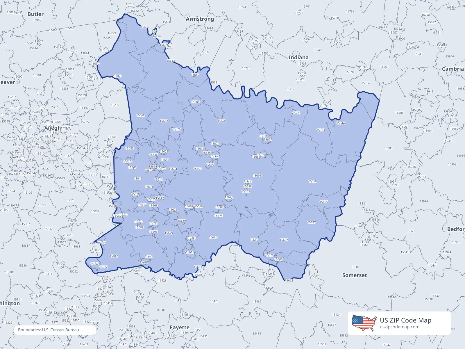
ZIP/ZCTA overlap with Westmoreland County
Population overlap
Share of each ZIP/ZCTA’s population located within Westmoreland County, based on ZIP Code Database county-overlap data. This is a population measure, not land-area overlap or the Census county population.
- 1501273.7%
Directory county
- 15062100.0%
Directory county
- 1506888.0%
Directory county
- 15072100.0%
Directory county
- 1508392.8%
Directory county
- 1508598.8%
Directory county
- 15087100.0%
Directory county
- 1508999.5%
Directory county
- 151316.2%
- 151370.1%
- 151460.3%
- 15448100.0%
Directory county
- 15479100.0%
Directory county
- 155010.5%
- 155310.9%
- 15601100.0%
Directory county
- 1561050.6%
Directory county
- 15611100.0%
Directory county
- 15612100.0%
Directory county
- 1561363.0%
Directory county
- 15615100.0%
Directory county
- 15616100.0%
Directory county
- 15617100.0%
Directory county
- 1561869.7%
Directory county
- 15619100.0%
Directory county
- 15620100.0%
Directory county
- 1562225.1%
- 15623100.0%
Directory county
- 15624100.0%
Directory county
- 15625100.0%
Directory county
- 15626100.0%
Directory county
- 15627100.0%
Directory county
- 15628100.0%
Directory county
- 15629100.0%
Directory county
- 15632100.0%
Directory county
- 15633100.0%
Directory county
- 15634100.0%
Directory county
- 15635100.0%
Directory county
- 15636100.0%
Directory county
- 15637100.0%
Directory county
- 15638100.0%
Directory county
- 15639100.0%
Directory county
- 15640100.0%
Directory county
- 15641100.0%
Directory county
- 1564299.7%
Directory county
- 15644100.0%
Directory county
- 15646100.0%
Directory county
- 15647100.0%
Directory county
- 15650100.0%
Directory county
- 15655100.0%
Directory county
- 1565658.0%
Directory county
- 15658100.0%
Directory county
- 15660100.0%
Directory county
- 15661100.0%
Directory county
- 15662100.0%
Directory county
- 15663100.0%
Directory county
- 15665100.0%
Directory county
- 1566688.1%
Directory county
- 1566899.5%
Directory county
- 15670100.0%
Directory county
- 15671100.0%
Directory county
- 15672100.0%
Directory county
- 15674100.0%
Directory county
- 15675100.0%
Directory county
- 15676100.0%
Directory county
- 15677100.0%
Directory county
- 15678100.0%
Directory county
- 15679100.0%
Directory county
- 15680100.0%
Directory county
- 1568147.8%
- 1568389.4%
Directory county
- 15684100.0%
Directory county
- 15687100.0%
Directory county
- 15688100.0%
Directory county
- 15689100.0%
Directory county
- 1569062.6%
Directory county
- 15691100.0%
Directory county
- 15692100.0%
Directory county
- 15693100.0%
Directory county
- 15695100.0%
Directory county
- 15696100.0%
Directory county
- 15697100.0%
Directory county
- 15698100.0%
Directory county
- 1571722.3%
- 15779100.0%
Directory county
- 15923100.0%
Directory county
- 1594460.4%
Directory county
- 1595445.8%
- 162292.8%
ZIP Code Database county-overlap table, field percent_of_zip_population_in_county, keyed by county_geoid. Not ACS 2019–2023. Overlap vintage is the shipped overlap table and is separate from ACS. Methodology
ZIP codes intersecting Westmoreland County
USPS associates these ZIPs with Westmoreland County
These codes list Westmoreland County as a primary or acceptable city. They are not used for the ACS headline.