
County · GEOID 48485
Wichita County, TX ZIP codes
11 ZIP/ZCTAs intersecting this county.
U.S. Census Bureau, ACS 2019–2023 5-year (vintage 2023). Geography: County Wichita County (GEOID 48485). Methodology
Combined population of ZIP/ZCTAs intersecting this county: 135,973 (11 ZIPs).
Combined population of ZIP/ZCTAs intersecting this county. Each intersecting ZIP contributes its full ZCTA population; overlap percents are descriptive only. This is not the Census county ACS headline above. Methodology
Wichita County, TX ZIP code map
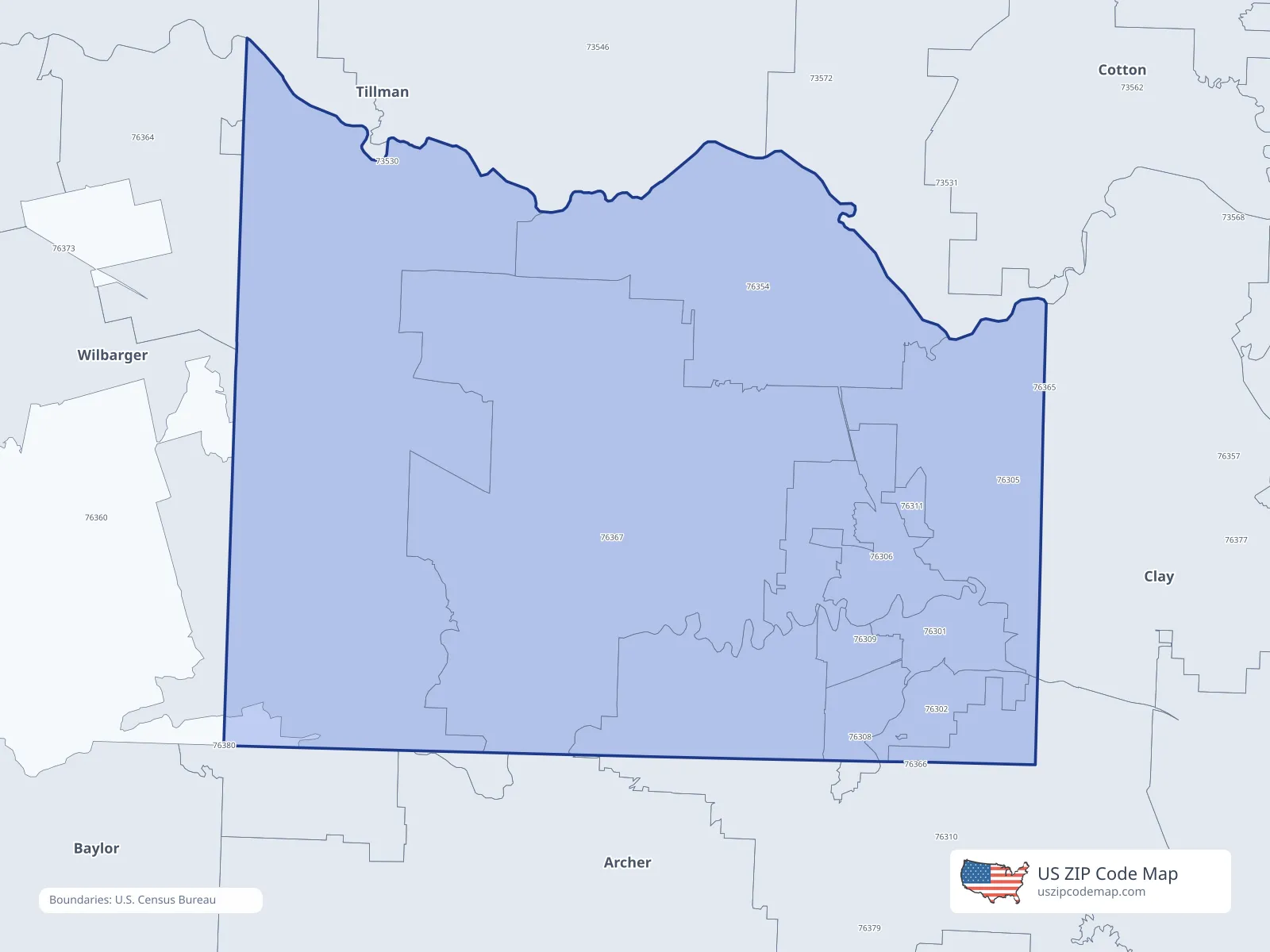
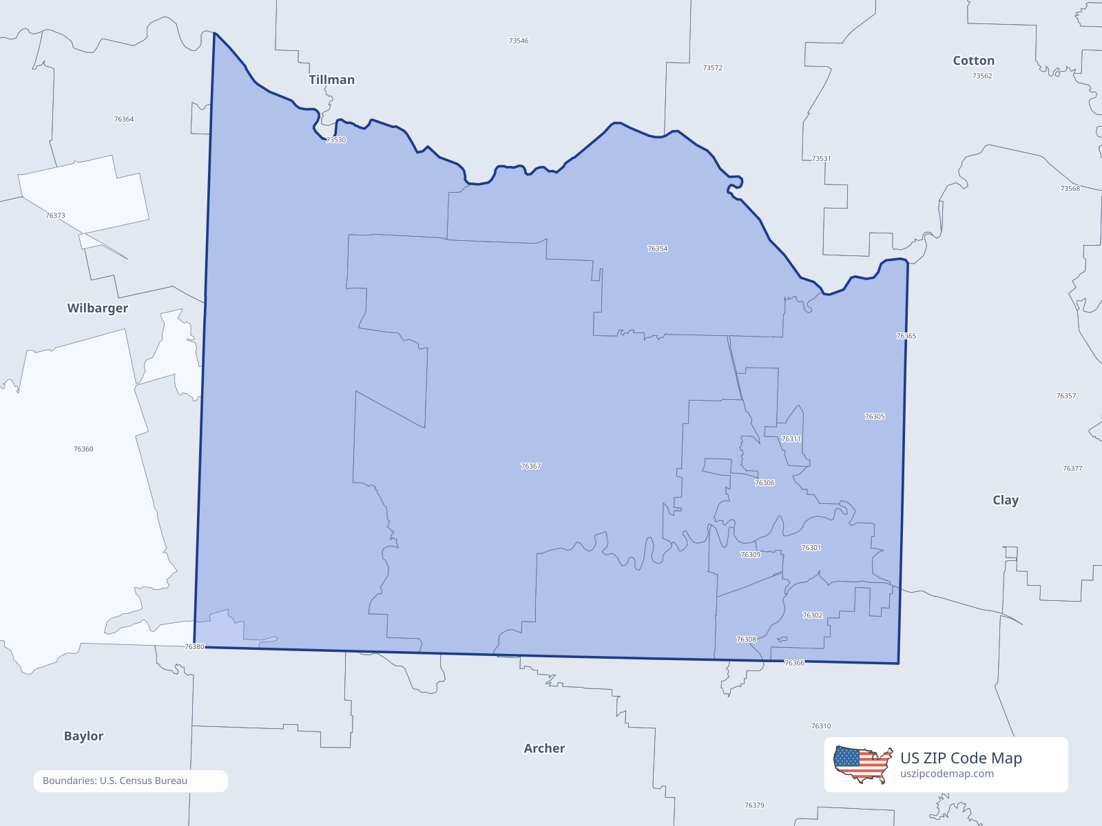
ZIP/ZCTA overlap with Wichita County
Population overlap
Share of each ZIP/ZCTA’s population located within Wichita County, based on ZIP Code Database county-overlap data. This is a population measure, not land-area overlap or the Census county population.
- 76301100.0%
Directory county
- 76302100.0%
Directory county
- 7630562.3%
Directory county
- 76306100.0%
Directory county
- 7630894.2%
Directory county
- 76309100.0%
Directory county
- 7631086.6%
Directory county
- 76311100.0%
Directory county
- 76354100.0%
Directory county
- 7636096.5%
Directory county
- 76367100.0%
Directory county
ZIP Code Database county-overlap table, field percent_of_zip_population_in_county, keyed by county_geoid. Not ACS 2019–2023. Overlap vintage is the shipped overlap table and is separate from ACS. Methodology
ZIP codes intersecting Wichita County
| ZIP | City | County | Population | Income |
|---|---|---|---|---|
| 76301 | Wichita Falls | Wichita County | 15,727 | $41,828 |
| 76302 | Wichita Falls | Wichita County | 11,949 | $56,744 |
| 76305 | Wichita Falls | Wichita County | 4,929 | $78,973 |
| 76306 | Wichita Falls | Wichita County | 14,487 | $47,004 |
| 76308 | Wichita Falls | Wichita County | 21,267 | $70,789 |
| 76309 | Wichita Falls | Wichita County | 13,344 | $51,886 |
| 76310 | Wichita Falls | Wichita County | 19,362 | $83,610 |
| 76311 | Sheppard AFB | Wichita County | 6,381 | $81,912 |
| 76354 | Burkburnett | Wichita County | 11,822 | $68,614 |
| 76360 | Electra | Wichita County | 2,692 | $66,050 |
| 76367 | Iowa Park | Wichita County | 14,013 | $78,056 |
USPS associates these ZIPs with Wichita County
These codes list Wichita County as a primary or acceptable city. They are not used for the ACS headline.
| ZIP | City | County | Population | Income |
|---|---|---|---|---|
| 76307 | Wichita Falls | Wichita County | 914 | — |
| 76369 | Kamay | Wichita County | 236 | — |